 https://ancientforestalliance.org/wp-content/uploads/2026/04/2025-Activity-Report-Financials-scaled.png
1440
2560
TJ Watt
https://staging.ancientforestalliance.org/wp-content/uploads/2014/10/cropped-AFA-Logo-1000px.png
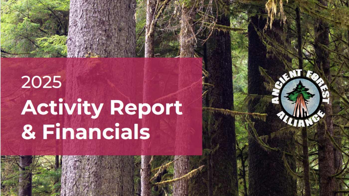
TJ Watt2026-04-30 16:32:192026-04-30 16:32:192025 Activity Report & Financials
https://ancientforestalliance.org/wp-content/uploads/2026/04/2025-Activity-Report-Financials-scaled.png
1440
2560
TJ Watt
https://staging.ancientforestalliance.org/wp-content/uploads/2014/10/cropped-AFA-Logo-1000px.png
TJ Watt2026-04-30 16:32:192026-04-30 16:32:192025 Activity Report & FinancialsRelated Posts
https://ancientforestalliance.org/wp-content/uploads/2026/04/2025-Activity-Report-Financials-scaled.png
1440
2560
TJ Watt
https://staging.ancientforestalliance.org/wp-content/uploads/2014/10/cropped-AFA-Logo-1000px.png
TJ Watt2026-04-30 16:32:192026-04-30 16:32:192025 Activity Report & Financials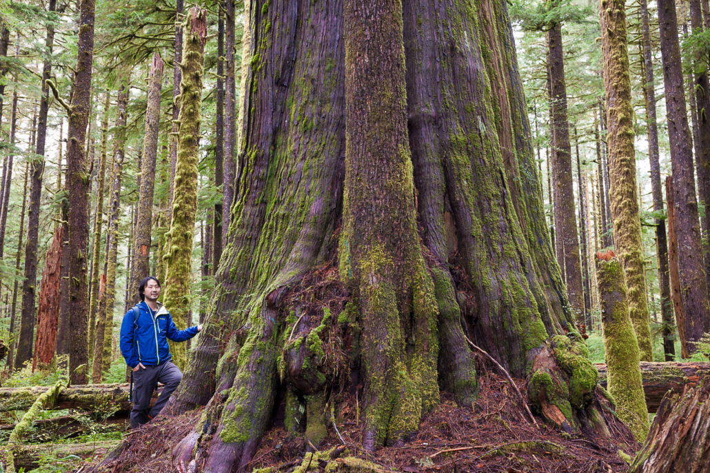 https://ancientforestalliance.org/wp-content/uploads/2025/09/5-Eden-Grove-Ken-Wu.jpg
1365
2048
TJ Watt
https://staging.ancientforestalliance.org/wp-content/uploads/2014/10/cropped-AFA-Logo-1000px.png
TJ Watt2026-04-27 16:22:282026-04-27 16:23:15The Tyee: BC ‘Going Backwards’ on Ecosystem Protections
https://ancientforestalliance.org/wp-content/uploads/2025/09/5-Eden-Grove-Ken-Wu.jpg
1365
2048
TJ Watt
https://staging.ancientforestalliance.org/wp-content/uploads/2014/10/cropped-AFA-Logo-1000px.png
TJ Watt2026-04-27 16:22:282026-04-27 16:23:15The Tyee: BC ‘Going Backwards’ on Ecosystem Protections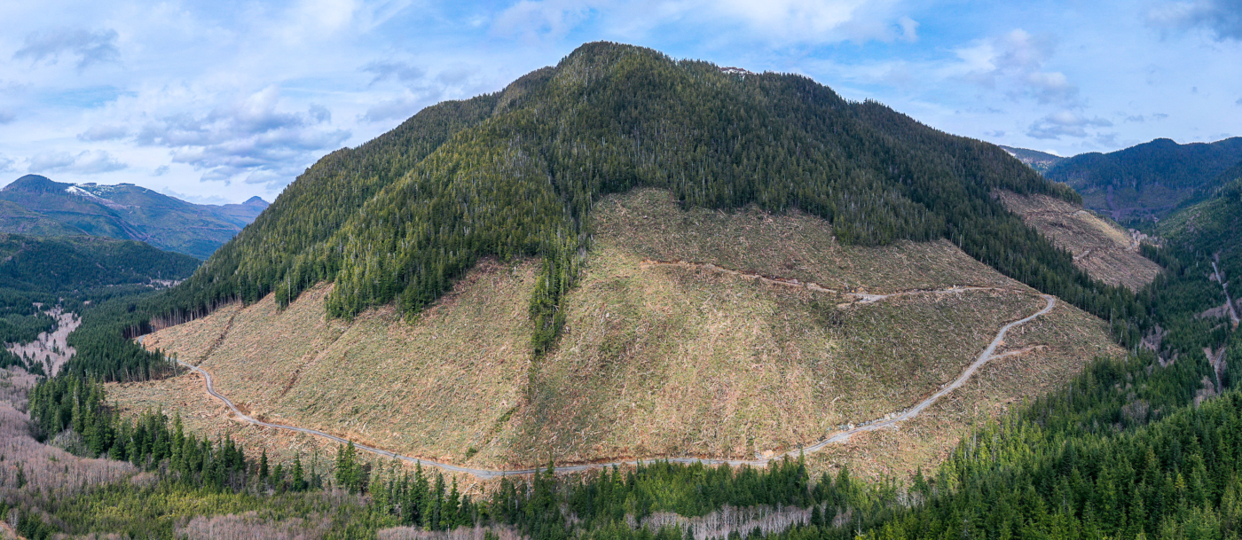 https://ancientforestalliance.org/wp-content/uploads/2026/04/4-BCTS-Old-Growth-Cutblock-Mahatta-River-scaled.jpg
1114
2560
TJ Watt
https://staging.ancientforestalliance.org/wp-content/uploads/2014/10/cropped-AFA-Logo-1000px.png
TJ Watt2026-04-23 15:49:152026-04-23 15:51:13The Tyee: BC Must Stop Blaming First Nations for Old-Growth Logging
https://ancientforestalliance.org/wp-content/uploads/2026/04/4-BCTS-Old-Growth-Cutblock-Mahatta-River-scaled.jpg
1114
2560
TJ Watt
https://staging.ancientforestalliance.org/wp-content/uploads/2014/10/cropped-AFA-Logo-1000px.png
TJ Watt2026-04-23 15:49:152026-04-23 15:51:13The Tyee: BC Must Stop Blaming First Nations for Old-Growth Logging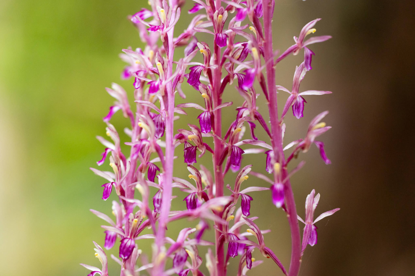 https://ancientforestalliance.org/wp-content/uploads/2026/04/western-coralroot-226.jpg
1366
2048
TJ Watt
https://staging.ancientforestalliance.org/wp-content/uploads/2014/10/cropped-AFA-Logo-1000px.png
TJ Watt2026-04-17 14:37:512026-04-17 14:37:51Western Coralroot
https://ancientforestalliance.org/wp-content/uploads/2026/04/western-coralroot-226.jpg
1366
2048
TJ Watt
https://staging.ancientforestalliance.org/wp-content/uploads/2014/10/cropped-AFA-Logo-1000px.png
TJ Watt2026-04-17 14:37:512026-04-17 14:37:51Western CoralrootTake Action
 Donate
Support the Ancient Forest Alliance with a one-time or monthly donation. Send a Message
Send an instant message to key provincial decision-makers.
6 months after old growth report, Island’s Green MLAs rap NDP for lack of action
/in News CoverageVancouver Island Free Daily
March 18, 2021
Forestry minister reiterates commitment to change, First Nations consultation
The Green Party of B.C. has been raising questions about old-growth logging in the legislature this week and last, challenging the government on its stated commitment to implement the 14 recommendations made by the old growth strategic review panel last year.
For three days, Green Party leader Sonia Furstenau argued that the NDP has missed the six-month deadline for immediate action to protect the highest risk old-growth forests, and has still not committed to a timeline on the project. On Wednesday, she and fellow Green MLA Adam Olsen read out submitted quotes from three Vancouver Island First Nations — Kwakiutl, Ma’amtagila, Nuchatlaht — who have old-growth concerns in their territory.
In response, the Minister of Forests, Lands, Natural Resource Operations and Rural Development, Katrine Conroy repeatedly said that the government is committed to implementing the recommendations and to engaging with Indigenous leadership. She listed the nine old-growth forests where the government temporarily deferred logging in September — none in the territories of the nations quoted — and reminded the MLAs that one of the authors is a Tahltan First Nation member from northern B.C.
Dorothy Hunt, an elected councillor for the Kwakiutl First Nation near Port Hardy and Port McNeill said:
“The Kwakiutl First Nation is not opposed to logging, but we have had a ban on old-growth logging in our territory for over 10 years. Yet new logging approvals continue to move forward without meaningful consultation and consent.
“We asked this government for deferrals in all remaining old-growth in our territory more than five months ago, and yet we still see new old-growth logging being approved in our salmon-bearing watersheds.”
The report, A New Future for Old Forests, was commissioned by the government in 2019 and released to the public in Sept. 2020 with 14 recommendations that would overhaul how old-growth forests are managed in B.C.
Two of the key recommendations were to engage Indigenous leadership, and “defer development in old forests where ecosystems are at very high and near-term risk of irreversible biodiversity loss.”
In September, the government temporarily deferred logging in nine old-growth forests it considered high risk in B.C., including Clayoquot Sound, McKelvie Creek and H’Kusam on Vancouver Island. Conroy, who wasn’t minister at the time, said those deferrals were made in consultation with First Nations in the areas.
None of those areas are in Kwakiutl territory, and yesterday Furstenau criticized the protected old growth as “stubby sub-alpine trees” that are not the big, ancient forests the old-growth panel was referring to.
“You can’t consult about trees that are already cut,” Olsen critiqued.
Read the original article
Critics cut into B.C. government’s protection plan for old-growth forests
/in News CoverageNational Observer
March 15, 2021
Environmental groups and the BC Green Party say the province’s failure to defer old-growth logging will exhaust the last remaining stands while a new forestry plan is developed. Photo by Louis Bockner
B.C.’s forestry minister made clear a moratorium on old-growth logging is off the table as she responded to critics of the government’s progress on a promise to overhaul its approach to forestry on Thursday.
BC Green Party Leader Sonia Furstenau pressed Minister Katrine Conroy during question period tooutline what meaningful actions government was taking to immediately protect critical old-growth forests, suggesting instead that the NDP was employing the “old strategy of talk and log.”
The questions arose after a coalition of environmental groups issued the province failing grades six months after it promised to act on recommendations stemming from a review of B.C.’s old-growth forestry practices.
Government intends to implement the old-growth panel recommendations to develop new holistic approaches to old-growth forests, Conroy said, adding a divisive, patchwork approach to the management of ancient forests took place in the past.
“Those who are calling for a return to the status quo are putting B.C.’s majestic old-growth and vital biodiversity at risk, and those who are calling for an immediate moratorium are ignoring the needs of thousands of workers and families in forest-dependent communities right across our province,” she said.
“We want old-growth forests to be appreciated by people today, and in years to come,” Conroy said.
“It’s also a priority for our government to support good jobs for people in B.C.’s forestry sector.”
The old-growth panel’s recommendations did not call for a complete moratorium on old-growth logging, but rather a deferral of operations within the first six months of the staged process to shift to a new approach to forestry, Furstenau clarified.
“The government has not responded to the advice that was given,” she said.
“The first step is the immediate interim protection across B.C. to create breathing room and protect what we have left.”
Government has already initiated two of the immediate recommendations, Conroy said, pointing to the collaboration with First Nations to establish old-growth logging deferrals in nine areas across the province.
Action has also started on other recommendations to improve public information and compliance, Conroy said.
“While we’ve taken these important first steps as recommended by the panel within six months, we know there is much more work to do,” Conroy said.
“We are dedicated to continuing in this important work with government-to-government discussions with Indigenous leaders, and talking to our partners in labour, industry, environmental organizations and communities.”
Torrance Coste, a campaigner with the Wilderness Committee — one of the trio of environmental groups that issued the negative report card on the province’s progress around the panel’s recommendations — agreed it was a critical priority for government to engage with First Nations to make the focus shift from timber harvesting to prioritizing ecological integrity in old-growth forestry management.
However, during that lengthy consultation process, it is urgent to protect what little remains of B.C.’s big-tree, old-growth forest ecosystems, Coste said.
“Absolutely, government needs to engage with First Nations. These forests grow in their territories and any solution needs to be centred in Indigenous rights,” Coste said.
“But if 10 years down the road, First Nations want to make the choice to either log their old-growth or protect it, they won’t have that choice if government doesn’t implement those deferrals now.”
The Wilderness Committee, along with the Ancient Forest Alliance and the Sierra Club BC, wants the province to meet the old-growth panel’s recommendations to develop a staged plan for its forestry transition, complete with concrete milestones and funding for the process, particularly for First Nations where logging deferral will cause economic hardship.
The Ministry of Forests, Lands and Natural Resource Operations (FLNRO) did not clarify if any more logging deferrals are planned — as promised by the NDP during the election — or whether concrete funds or timelines for the transition are being established.
“The economic impacts of its recommendations need to be analyzed,” FLNRO said in an email Friday.
The panel’s timeline for recommendations indicated when work should be started — not completed — and the timeline was developed prior to the pandemic, the ministry added.
“COVID-19 is impacting every community and (First) Nation in the province, presenting added challenges to the engagement process,” FLNRO said.
“That said, we are moving forward with this engagement process, but it will take time.”
Coste disputed there is any time left to avoid old-growth deferrals, particularly for the most at-risk, valley bottom old-growth, as it’s more easily accessible, worth more, and being targeted by logging companies.
There is only around 400,000 hectares of big-tree old-growth left in the province, he said.
“What you picture when you close your eyes and think of old-growth forest, that’s very, very scarce,” Coste said.
“You might think it’ll get protected because that’s what the panel recommended.
“But, when the minister says, ‘We can’t rush this,’ it’s like hearing we can’t rush CPR when someone needs it.”
Rochelle Baker / Local Journalism Initiative / Canada’s National Observer
[Editor’s Note: This story was updated Monday morning to correct a figure in this story that stated there were 200,000 hectares of old growth in B.C. when it should read there are 400,000 hectares.]
Read the original article
Nothing but delays: Old-growth logging continues as B.C.’s commitments to change slip
/in News CoverageThe Globe and Mail
March 14, 2021
British Columbia’s rare and ancient trees continue to vanish into sawmills at worrying rates despite the Great Bear Rainforest agreement reached with great fanfare five years ago to protect the largest coastal temperate rainforest on the planet.
The province’s NDP government, re-elected last fall with a commitment to lead a paradigm shift in forestry, is mired in planning and consultation.
“The promise of the Great Bear Rainforest was to change this broken system,” said Nicole Rycroft, executive director of Canopy, a non-profit group that partners with forest-product customers – including Penguin Random House, Kimberly Clark, Scholastic and The Globe and Mail – to advance conservation.
Some of the biggest names in the print publishing world gathered for a virtual conference in early Marchto hear how B.C. is living up to the Great Bear Rainforest agreement. They left disappointed.
“Things are clearly substantively behind schedule,” Ms. Rycroft said. Representatives for companies partnered with Canopy “left the call with a number of questions around how the government could be clearly not fulfilling the public commitment that was made.”
The 2016 Great Bear Rainforest agreement, the product of 20 years of negotiations between environmentalists, forestry companies, Indigenous communities and the provincial government, was forged under market pressure. More than 80 companies, including Home Depot, Staples and IKEA, had been persuaded to stop selling products made from B.C.’s old-growth forests. The deal’s signing brought those customers back – with the promise that buying B.C. forestry products would help them meet their own commitments to environmental values.
British Columbia reaped international accolades for the deal, which applied to 6.4 million hectares of the coast from the north of Vancouver Island to the Alaska Panhandle.
The agreement promised to protect 85 per cent of the region’s old-growth forests, with logging in the remaining 15 per cent subject to the most stringent standards in North America. But since it was signed, more than 10 million cubic metres of timber have been harvested in the Great Bear without the enforcement mechanisms that were supposed to ensure ecosystem-based management is being applied.
Instead of setting aside the rare and iconic big trees for protection, “there are a lot of very big stumps,” said conservation biologist Jody Holmes, an architect of the agreement.
Canopy is proposing to halt old-growth logging in the Great Bear until individual logging plans are approved – and so far, not one plan has been approved. B.C. Forests Minister Katrine Conroy, who would not provide that commitment, told those at the March meeting that progress is being made, but the issues are complex. “We have to do this right; we can’t rush this,” she said later in an interview.
Marilyn Slett is the chief councillor of the Heiltsuk Nation, whose territory encompasses a substantial portion of the Great Bear Rainforest. “We’re not thrilled with the pace of change,” she said in an interview. The Heiltsuk want to protect old growth in their territory, and there is frustration that the targets in the agreement have fallen behind schedule. The process is overly complex, she said.
“But relationships take time, and we are in it for the long haul,” she said.
British Columbia is home to 57 million hectares of forests, but ancient, temperate rainforests are astonishingly rare. A recent study found that those highly productive, intact ecosystems make up less than 1 per cent of B.C.’s remaining forests.
In 2019, the government set up an expert panel to review the divisive issue of old-growth logging. The panel’s report was not released until last fall, and during the election campaign, the NDP promised to enact all of the panel’s recommendations.
But the timeline for these changes is also slipping, and one long-running act of civil disobedience captures the dismay with the lack of progress.
For more than 200 days, protesters have maintained a remote forest blockade against logging in a valley on Vancouver Island. Fairy Creek is part of Tree Farm Licence 46 and features increasingly rare intact stands of Western redcedar and yellow cedars, trees that are up to 800 years old.
The Fairy Creek demonstrators could soon face arrest. An application brought by the logging company, The Teal-Jones Group, will be heard in court on March 26. The escalating conflict unfolding in Premier John Horgan’s riding underscores the gap between the Premier’s campaign commitments and the unabated harvesting of some of the biggest, oldest and most valuable trees left in the province.
Mr. Horgan says his government is moving towarda new way of practising forestry,one that sustains the biodiversity in B.C.’s ancient forests while allowing forestry companies to extract more value from the timber that is harvested. There are no shortcuts, he said.
“This is an intractable problem in British Columbia, and I believe we’ve laid the groundwork for a positive resolution, but it’s a paradigm shift in how the industry operates,” he said in an interview Friday.
“It is not my intention to see the last big tree felled – quite the contrary. “
He knows the iconic status attached to those old-growth forests, but he said big trees will continue to fall while the new rules are developed.
His party was in government in the 1990s when more than 850 people were arrested at Clayoquot Sound, a fight that was dubbed the War in the Woods. The fight to protect the Great Bear Rainforest, although waged in boardrooms, was the province’s second major land-use war.
Dallas Smith is president of the Nanwakolas Council,which represents six of the First Nations in the Great Bear Rainforest, and one of the Indigenous leaders who signed the accord five years ago.
The blockades at Fairy Creek are a symptom of rising tension, he warns, because the province has been dragging its heels on reform. “To have the audacity to campaign on old growth, and then still just not do anything. … I see the War in the Woods 3.0 coming pretty quick,” he said.
Gerrie Kotze, vice-president and CFO of The Teal-Jones Group, noted that his company consulted with local First Nations before starting its harvesting plans this year.
“Engagement and reconciliation with First Nations is core to our values,” he said in a written statement. The province already does balance conservation with economic activity, he said. “We support this balanced approach to the province’s land base, and respect that significant stands of forested lands have been set aside for conservation.”
While the blockade has halted Teal-Jones’ logging operations in Fairy Creek, the company has been logging nearby, in the Caycuse watershed.
Environmentalists are concerned.
“That’s the best old-growth forest that’s been destroyed on southern Vancouver Island in the last five years, and it was planned, applied for, permitted, and logged after the government commissioned the old-growth report,” said Torrance Coste, national campaign director for the Wilderness Committee. “Every week that we wait, there’s less and less old growth to protect.”
Read the original article